Phases
Providing permission for the proposed extension is granted, future quarry operations will take place over six phases, estimated to commence in 2025 and to end in circa 2085, assuming the current output is maintained and that the site has sufficient reserves for 60 years from now.
In terms of the storage of the non-saleable shale spoil created from the proposed extension, initially this will be disposed of in the current void within the existing western tip, and within the recently approved tip extension area as per planning permission PA23/03567. Once the tip is full, shale spoil will be temporarily backfilled on the upper levels of the proposed extension area and then backfilled into the quarry void as restoration once extraction there is complete.
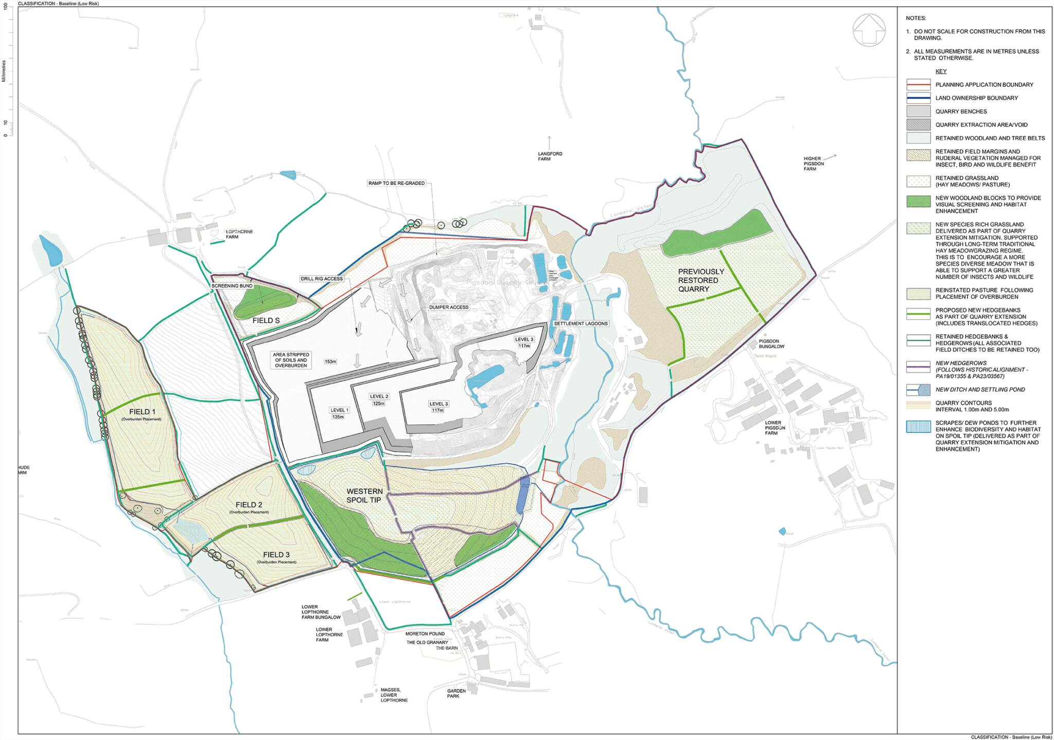
Phase 1 (years 0 – 8)
The Phase 1 drawing shows the quarry face positions after 8 years. At this point the existing shale tip and its extension area will be either nearly filled or fully filled with restoration near completion. The following elements will take place within Phase 1 in chronological order:
- The diversion of a number of overhead power lines underground.
- Hedgerow translocation.
- Stripping of topsoil from Fields A and B, as well as the remaining consented area, and the three overburden placement fields.
- Overburden will then be stripped from Fields A and B as well as the remaining consented area and placed on the three overburden placement fields to the west of Lopthorne Lane. These fields will be topsoiled, seeded and restored to agricultural use.
- Extraction will then commence on the top levels of part of Field B to create space for the temporary backfill of shale spoil in this phase.
- Extraction will take place at a deeper level within the existing quarry void.
- The non-saleable shale spoil produced in Phase 1 will be stored in the existing tip.
Phase 2 (years 9 – 20)
The Phase 2 drawing shows the quarry face positions after 20 years. The following elements will take place within this phase:
- Extraction of the top levels of Fields A and B and the remaining consented area will progress to the west and north, covering the whole of Field B and part of Field A.
- Extraction to a deeper level will take place within the existing quarry void.
- The non-saleable shale spoil produced in Phase 2 will be backfilled onto level 2 of Fields A and B and the remaining consented area as extraction progresses further wes and north during this Phase.
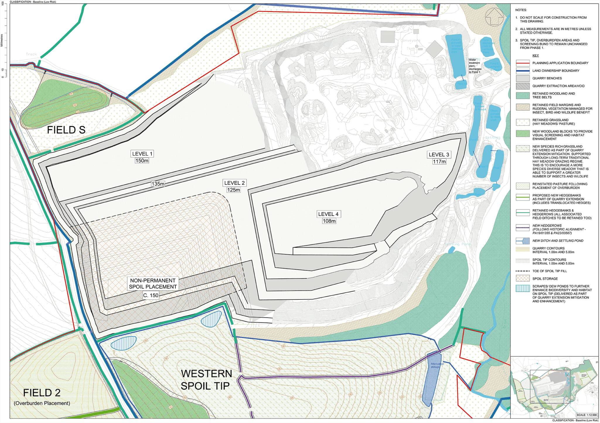
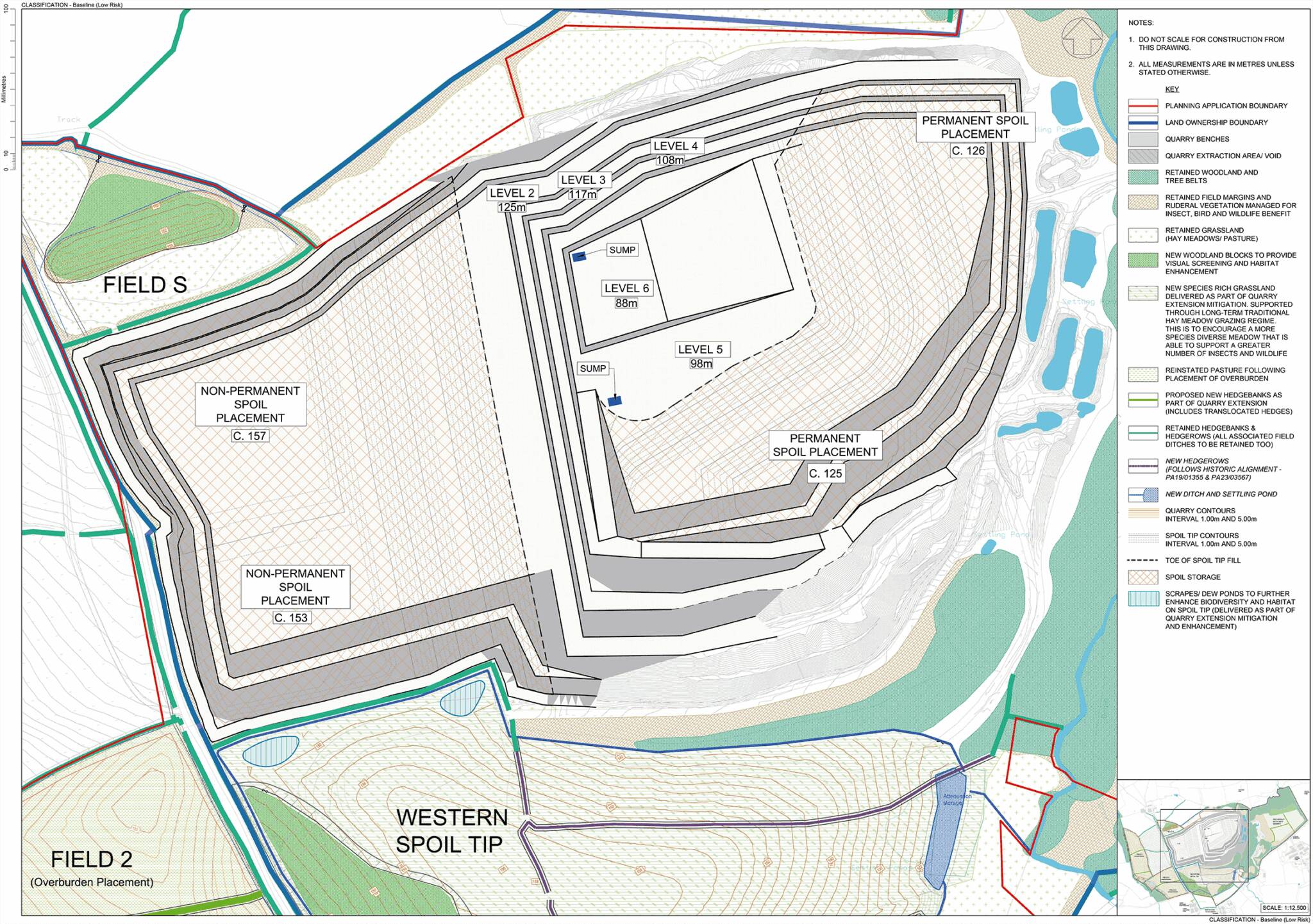
Phase 3 (years 21 – 37)
The Phase 3 drawing shows the face positions after 37 years. The following elements will take place within this phase:
- The top level of minerals in Fields A and B and the remaining consented area will be worked to the northern boundary.
- Fields A and B and the remaining consented area will then be backfilled with shale spoil both from extraction here and from within the current quarry void.
- Extraction will take place to a deeper level within the current consented area.
- Non-saleable shale spoil produced in Phase 3 will be permanently stored on levels 1, 2 and 5 in the quarry.
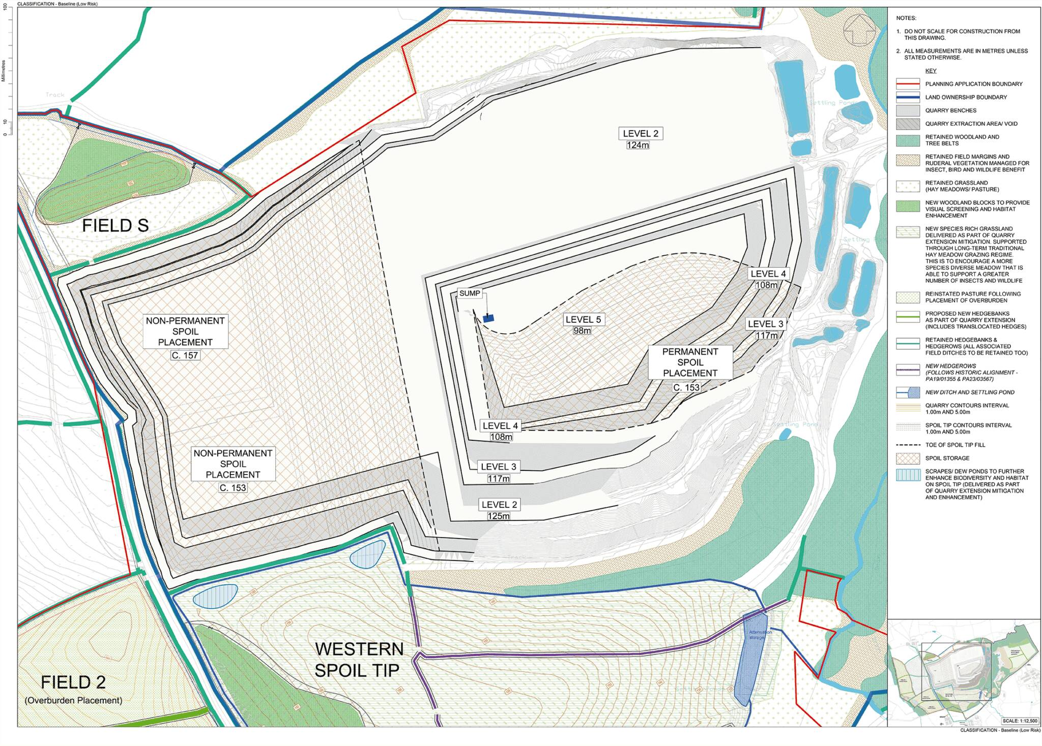
Phase 4 (years 38 – 47)
The Phase 4 drawing shows the face positions after 47 years. The following elements will take place within this phase:
- The northern area of the consented quarry used for plant storage
and mineral stockpiling during Phase 3 will be worked to a deeper level
in this phase.
- The non-permanent storage area for the
non-saleable shale spoil will extend northwards along the eastern
boundary of the quarry.
- A new ramp to the deepest level will be constructed.
- The shale spoil produced in Phase 4 will be backfilled into the quarry void as restoration.
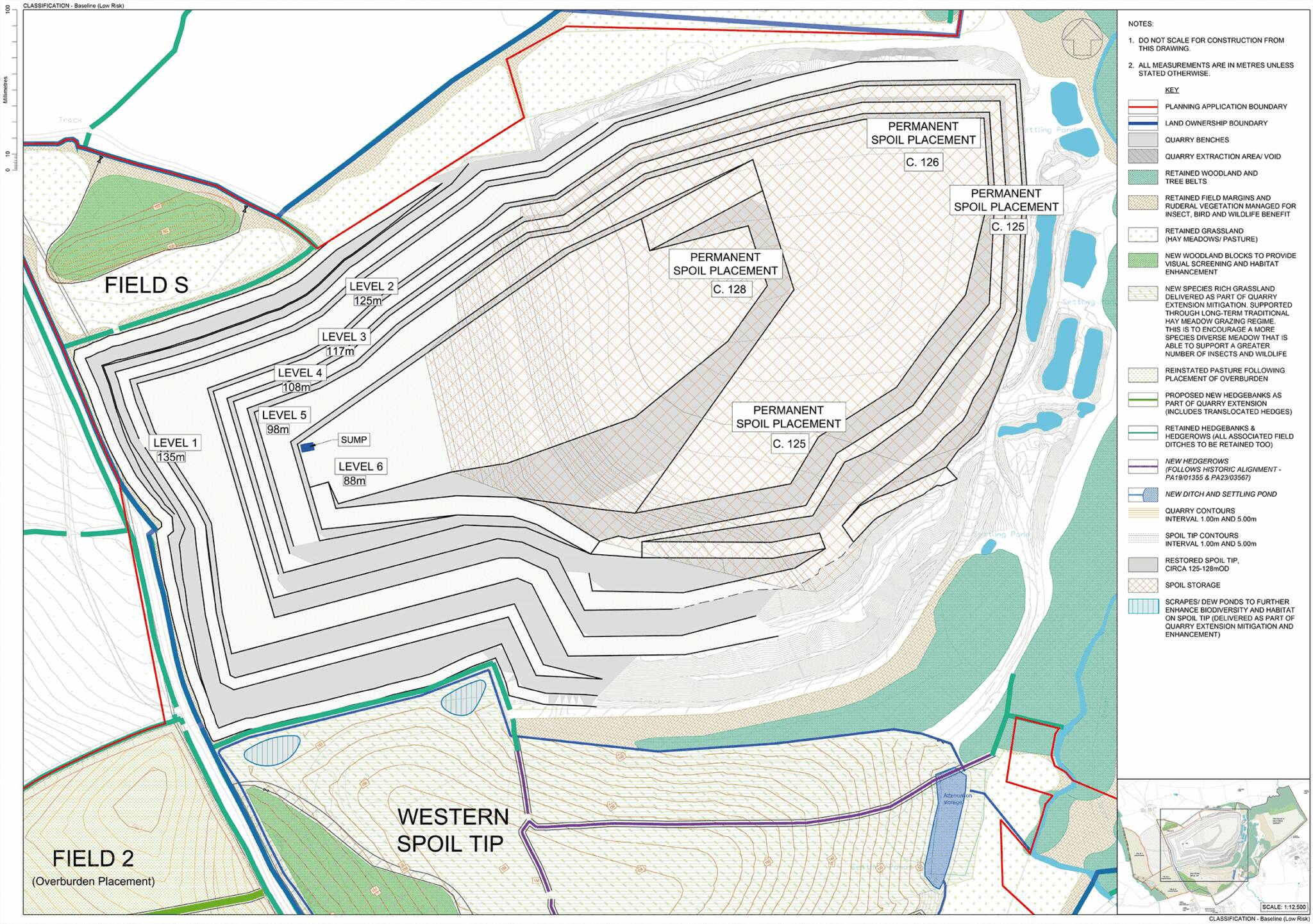
Phase 5 (years 48 – 60)
The Phase 5 drawing shows the face positions after 60 years. The following elements will take place within this phase:
- Final mineral extraction at all remaining levels where there is the market demand.
- The temporary storage of shale spoil on the top levels of the proposed extension fields will be backfilled into the quarry void to infill the lower levels for restoration.
- This will enable deeper extraction
in the proposed extension area. A small amount of shale spoil will
remain around the northern, western and southern perimeters of the
extension area to naturally restore this area.
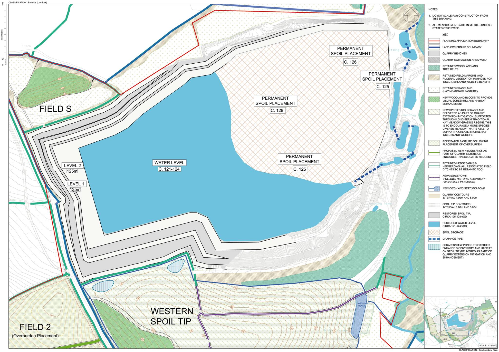
Phase 6 (restored)
The Phase 6 drawing shows how the quarry’s void could look at final restoration. It is predicted that the water level will recover to between 121-124m OD in the western and southern areas of the void. The permanent spoil placement area in the north-eastern corner of the quarry will provide opportunities for species rich grassland to contribute towards a varied habitat provision on site. Wetland areas are also present at the lower grassland levels and around the permanent water bodies within this indicative restoration of the quarry.
The Final Restoration Phase Landscape and Ecological Mitigation Plan provides further details on indicative restoration of Pigsdon Quarry.